Cool Stuff: J.E. Fullerton's Insanely Detailed 'Game Of Thrones' Map
It's to George R.R. Martin's massive credit that the world of Game of Thrones (or A Song of Ice and Fire, if you insist, bookworms) feels so incredibly real. Westeros is a big, sprawling region filled with complex societies, messy histories, and unique citizens, not unlike our own country. But while all those details help bring that fantasy land to life, they can also be awfully hard for show fans and book readers to navigate the world without getting lost.
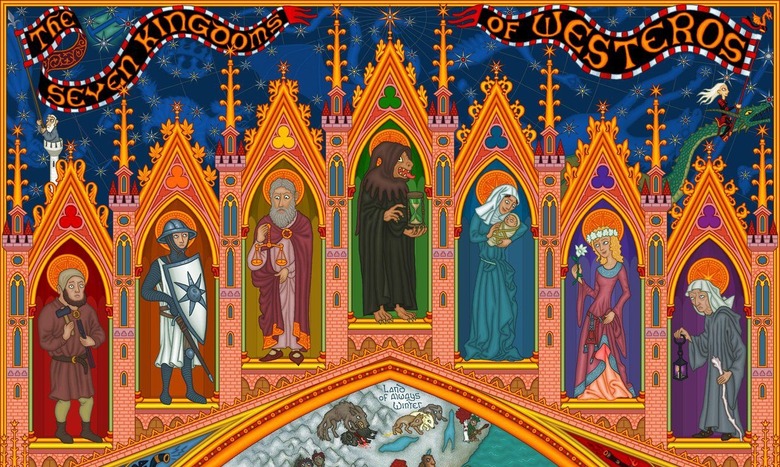
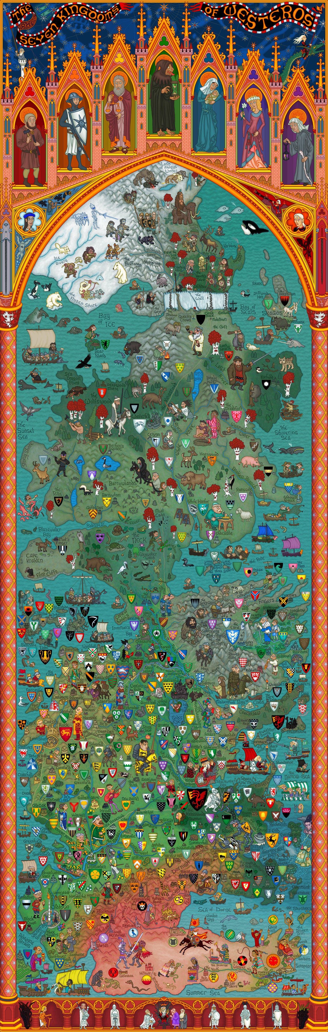
The series alleviates that issue somewhat by opening each episode with an animated map, but plenty of fans have taken up the call as well. Today, we have a very detailed, colorful map by artist J.E. Fullerton that not only details which landmarks and families go where, but conveys each region's personality with gorgeous, frequently funny illustrations. Hit the jump to check it out.
Fullerton apparently took these pictures down at one point, but other fans saved them and so they continue to circulate on the Internet. All images below are via Comics of Ice and Fire.
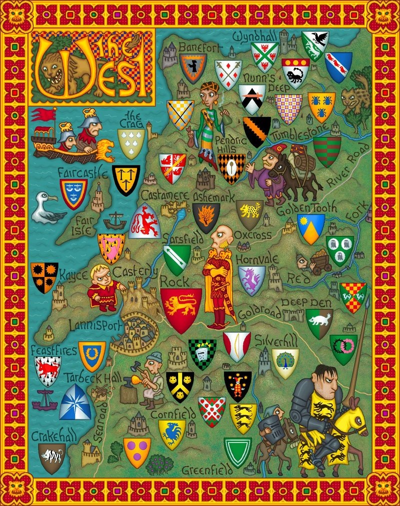
Let's start with the most impressive work, a full-sized map of Westeros. You'll definitely want to click to enlarge so that you can fully appreciate the details.
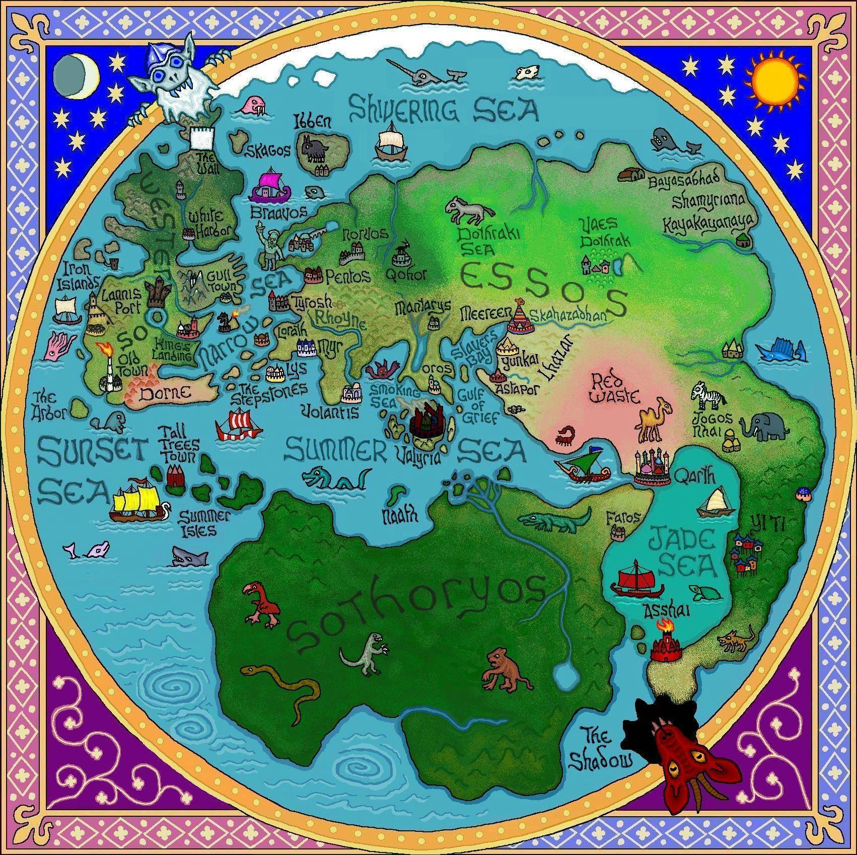
While Game of Thrones mostly takes place in Westeros, that's not the only continent in Martin's world. Fullerton also has a map showing the entire world — or what we know of it so far, anyway.
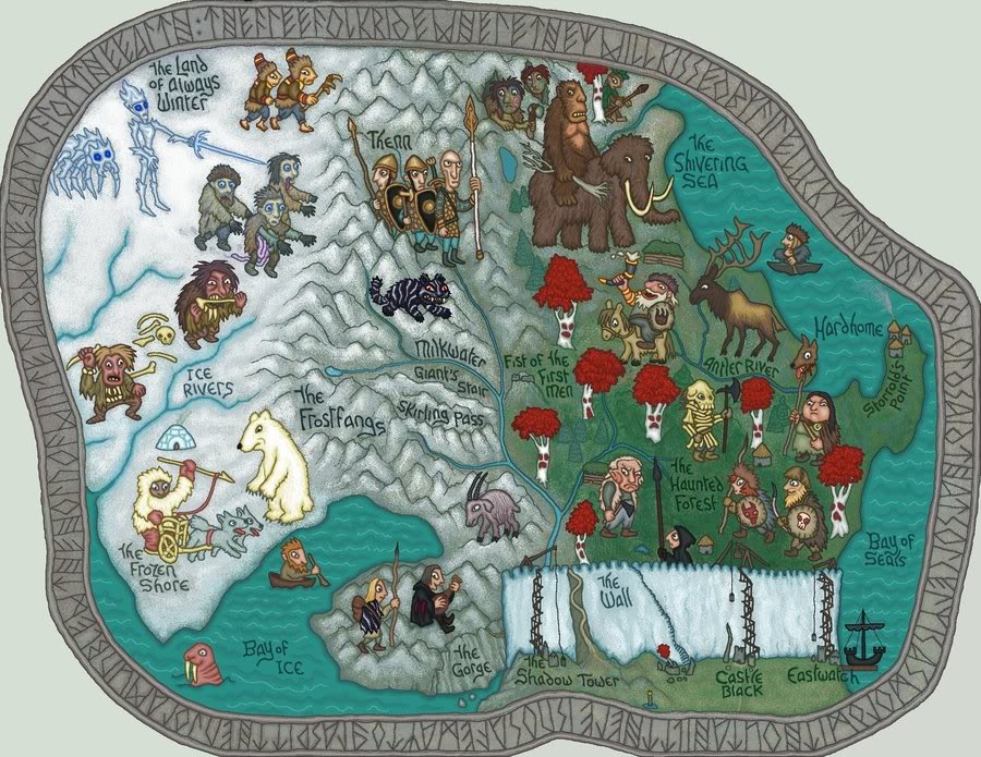
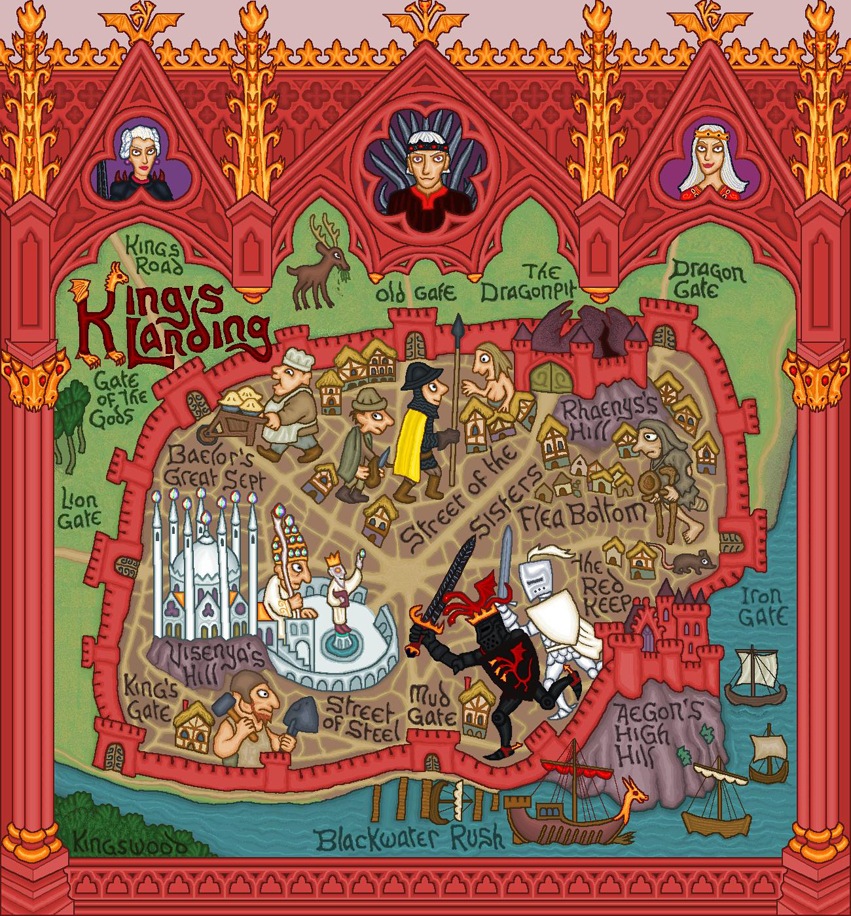
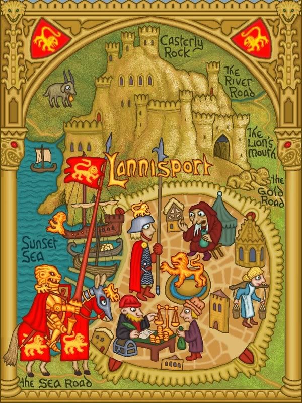
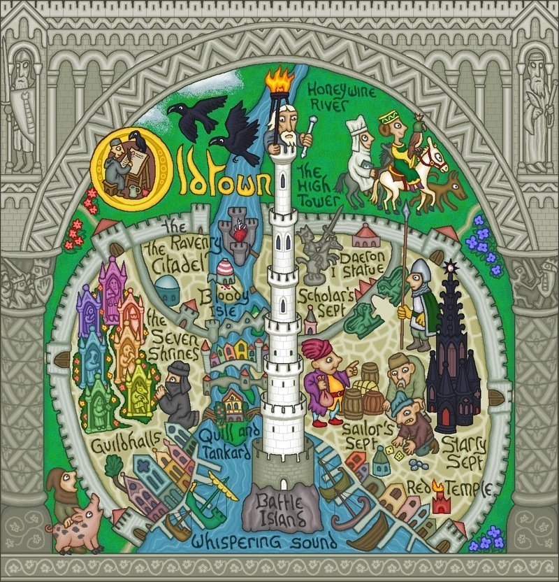
Now to zoom in a little. Here are some close-ups of the various regions of Westeros.
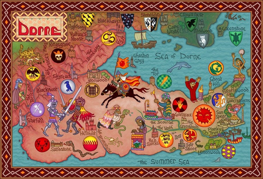
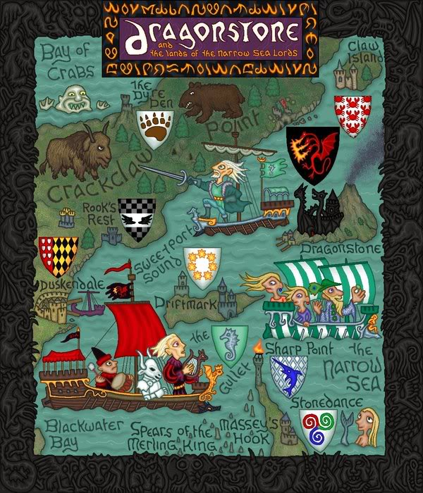
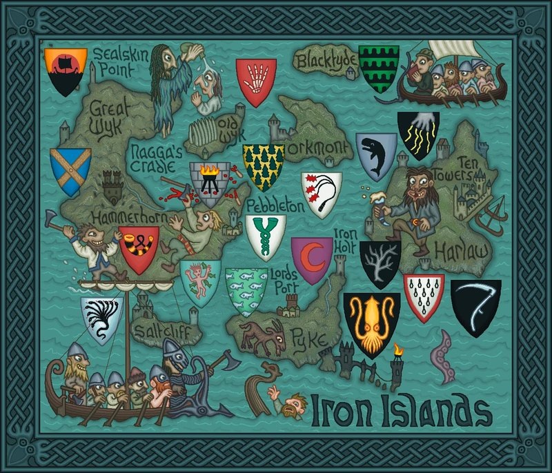
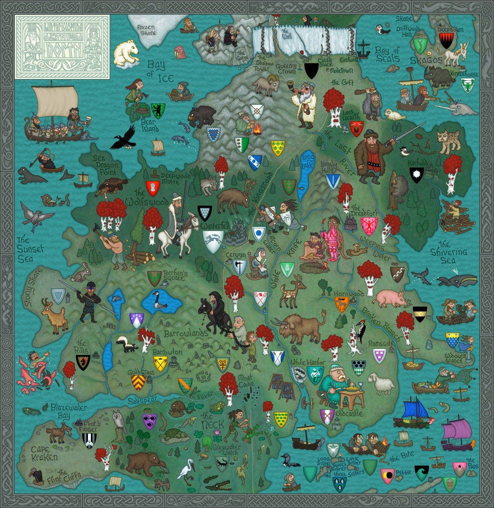
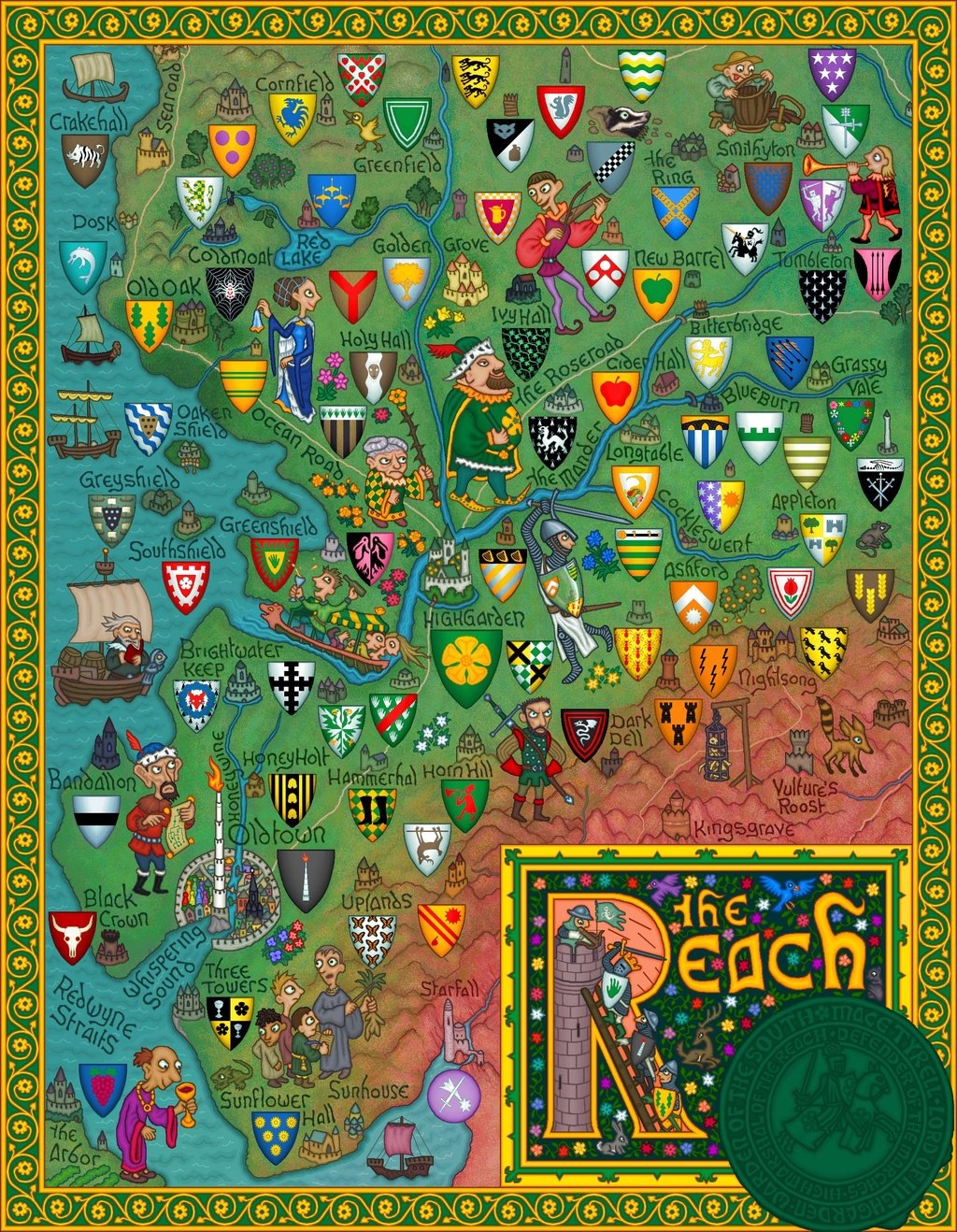
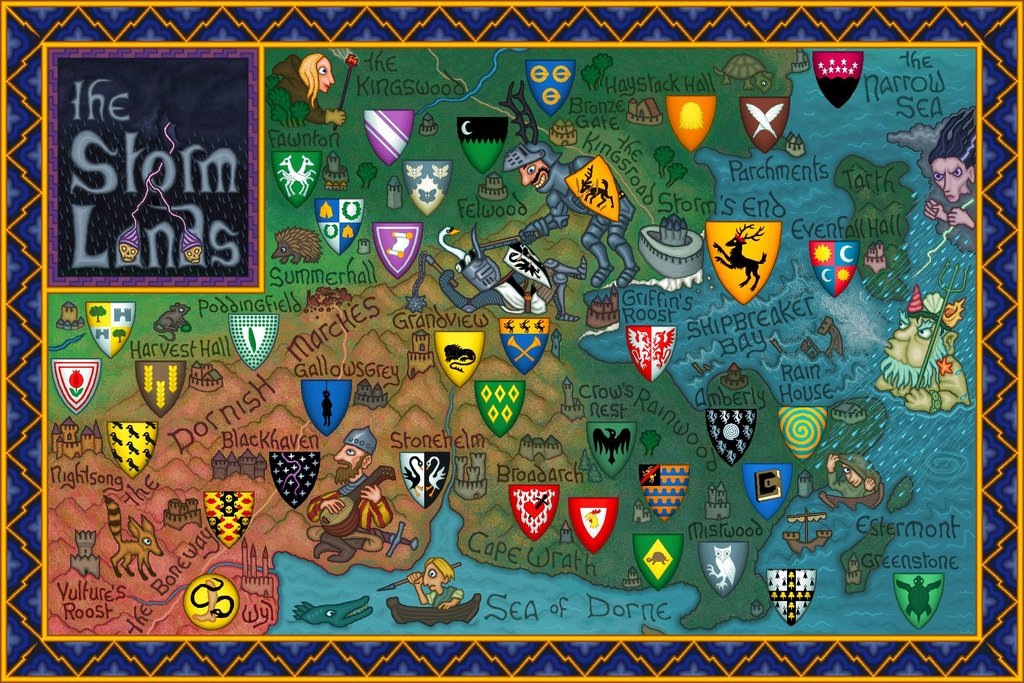
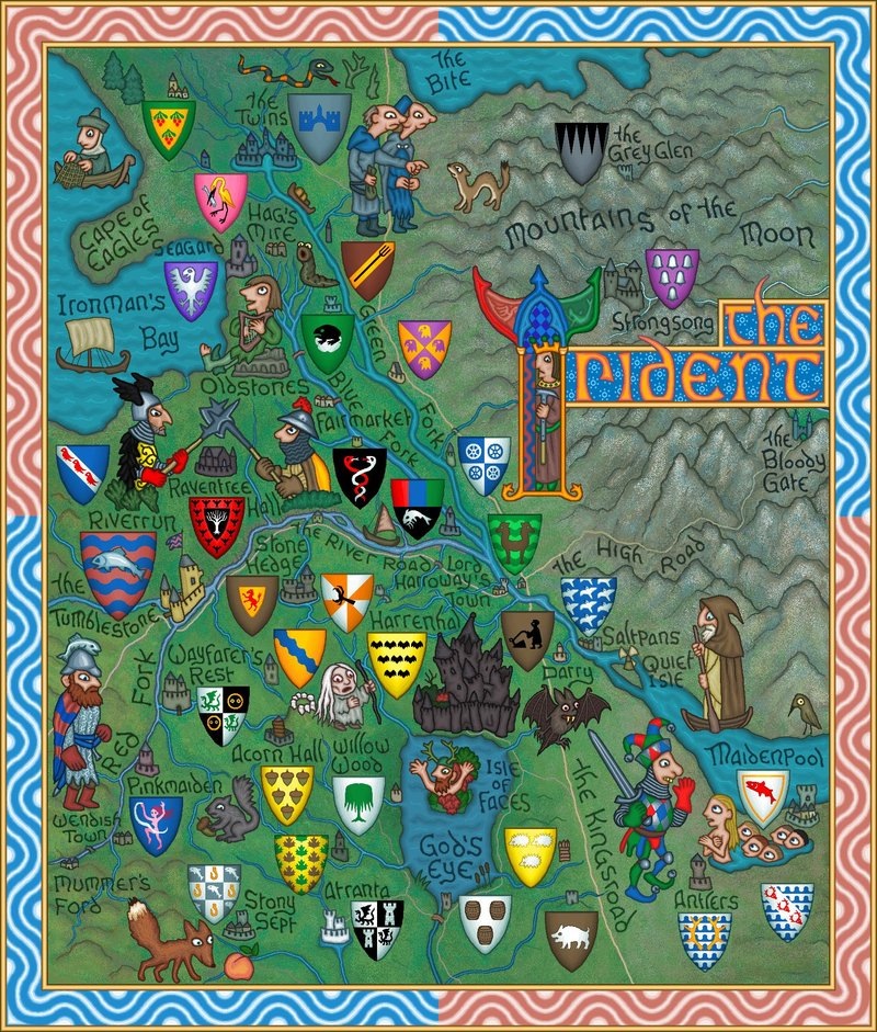
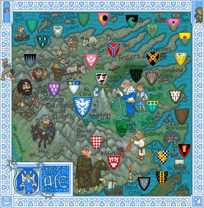
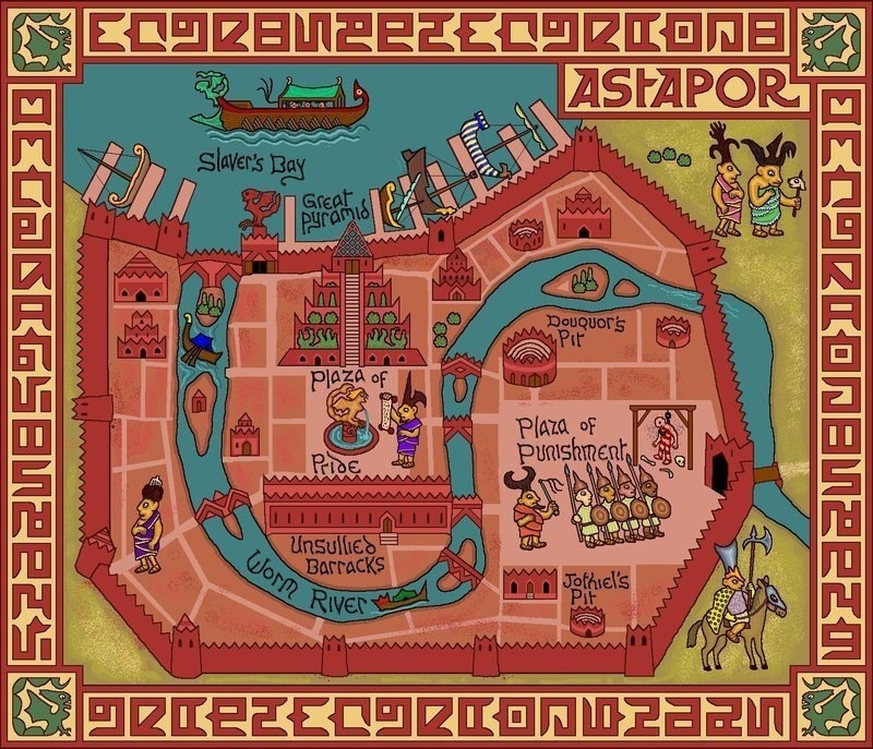
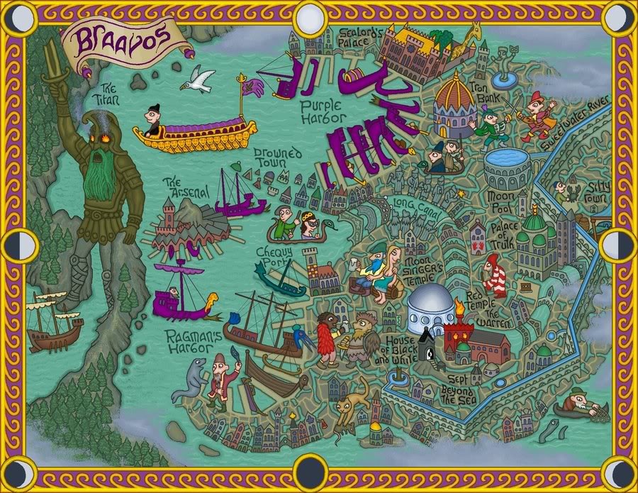
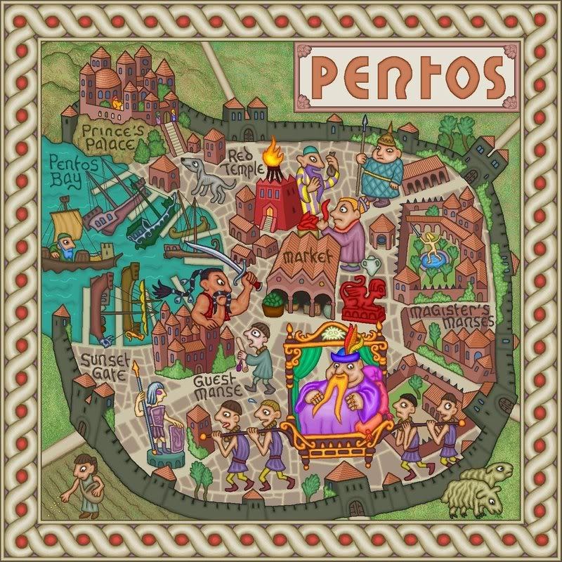
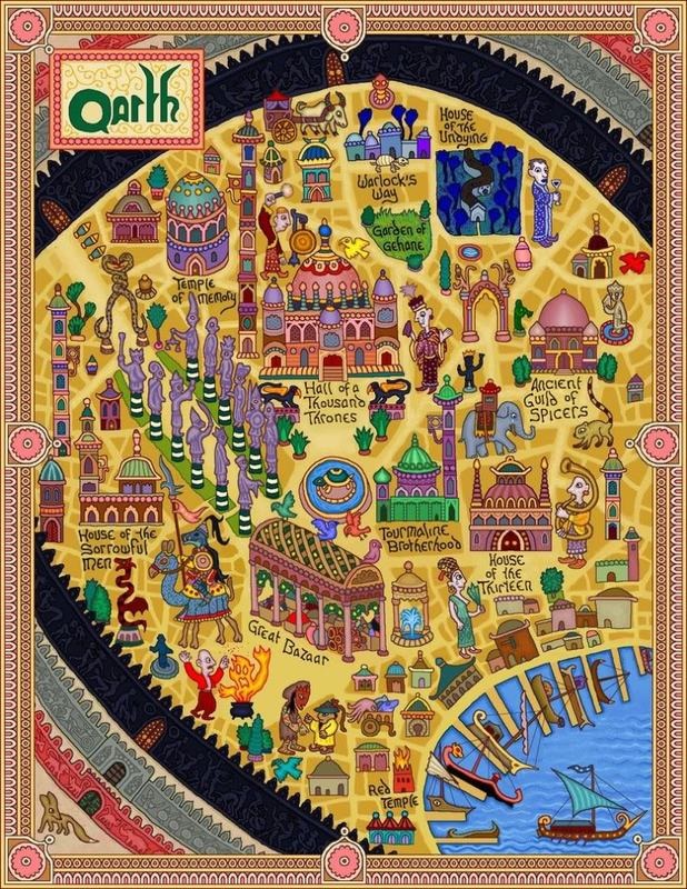
And the cities, which are drawn in far more detail than in the giant map above.

And here's what lies across the Narrow Sea.
Which pictures are your favorites?